
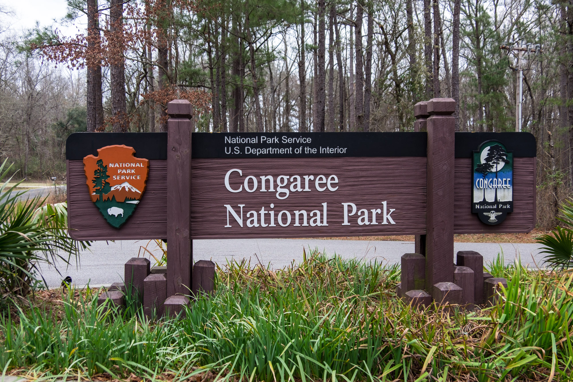
Congaree National Park, South Carolina, USA | Park 8/59


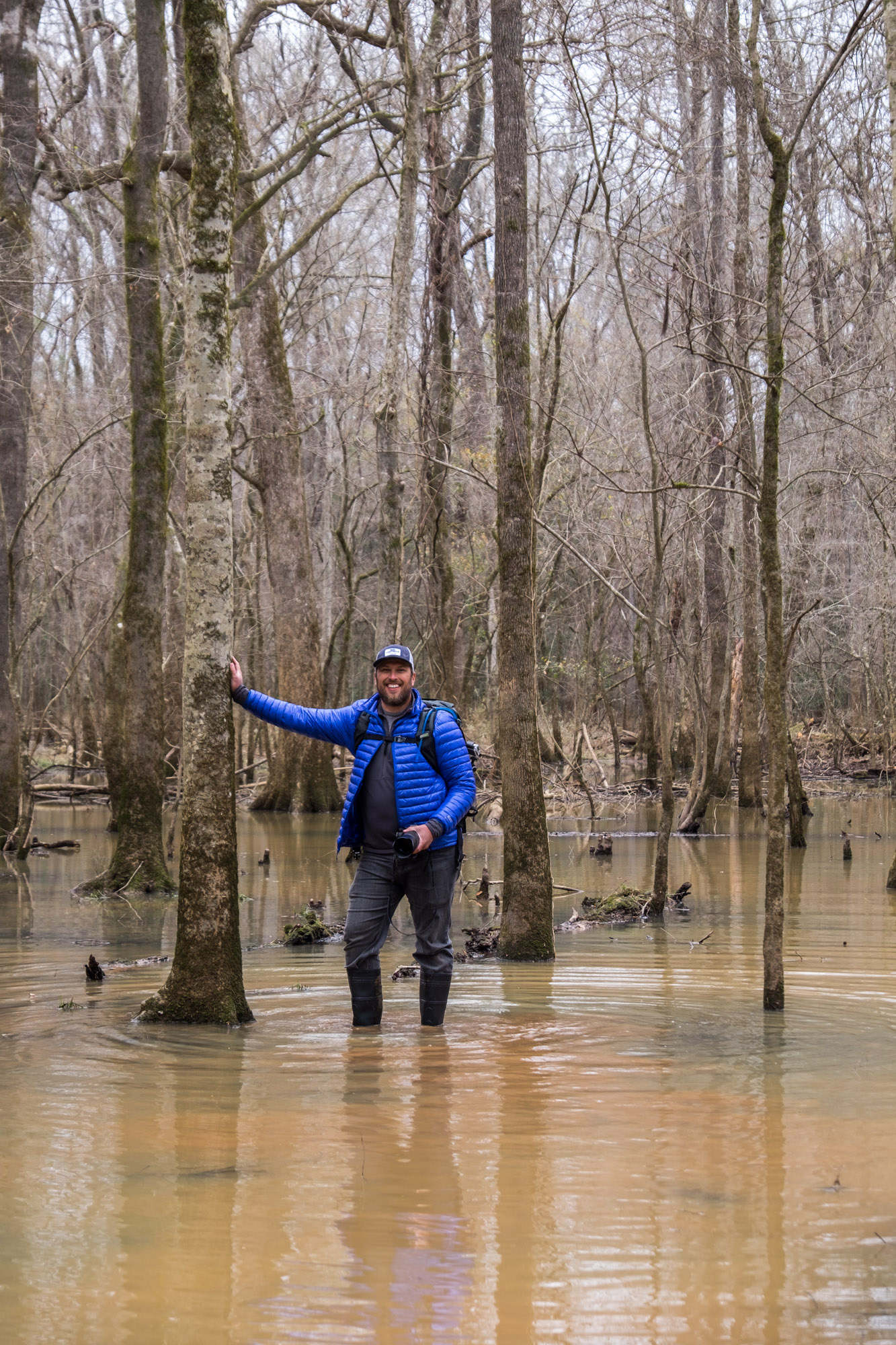


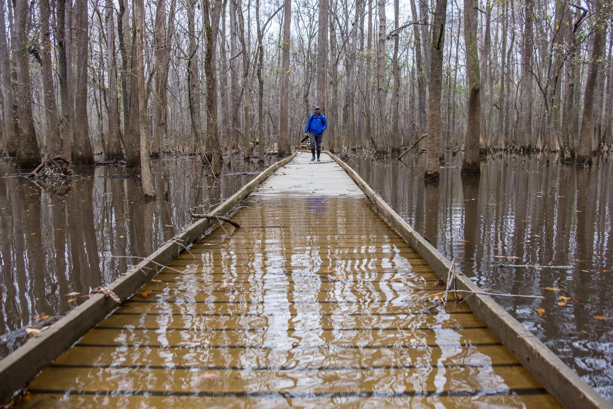
Jonathan enters a flooded Congaree National Park.
Knee-Deep in Nature: Congaree National Park
On photography, Jon once gave me a tip I’ll never forget: "sit, wait, and let the photo happen in front of you. Then capture it." I was told basically the same thing about experiencing Congaree National Park by a plain-clothed volunteer ranger I sniffed out while walking on the boardwalk. "See any wildlife?" I asked as we passed. "The wildlife are very shy here," she said. "They have a right to be. But if you sit on one of the benches for five, maybe ten minutes, they will come to you—the entire forest will open up."
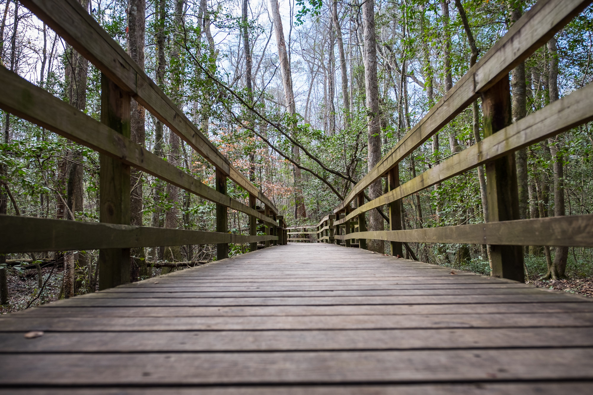
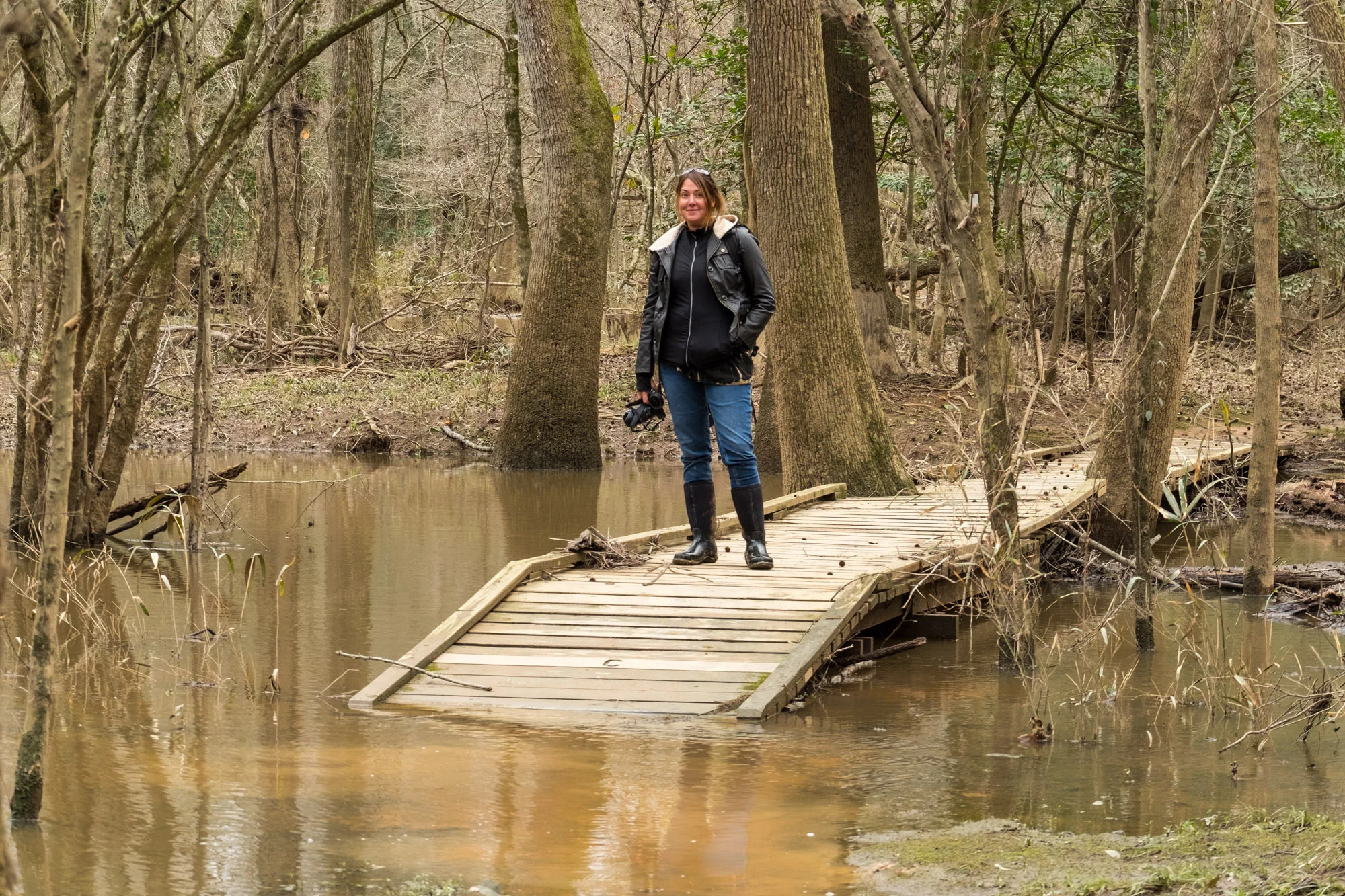
We brought our muck boots with us because the floodplain had opened up, as it does this time of year, swallowing the iconic boardwalk pathway that leads away from the visitor center. We were in for a muddy, mucky adventure. But this is not a swamp. Ranger Scott made it clear that this is not a swamp, but a dynamic river floodplain running through an old growth forest of naked Cypress trees. When the waters flood in from the adjacent Congaree and Wateree Rivers, nutrients and sediments sweep in with them nourishing the ecosystem that is home to a diverse habitat of birds, amphibians, fish, reptiles, insects, and mammals. With all of that in mind, we walked carefully on.

We made the smart decision of continuing on along the Weston Lake Loop.
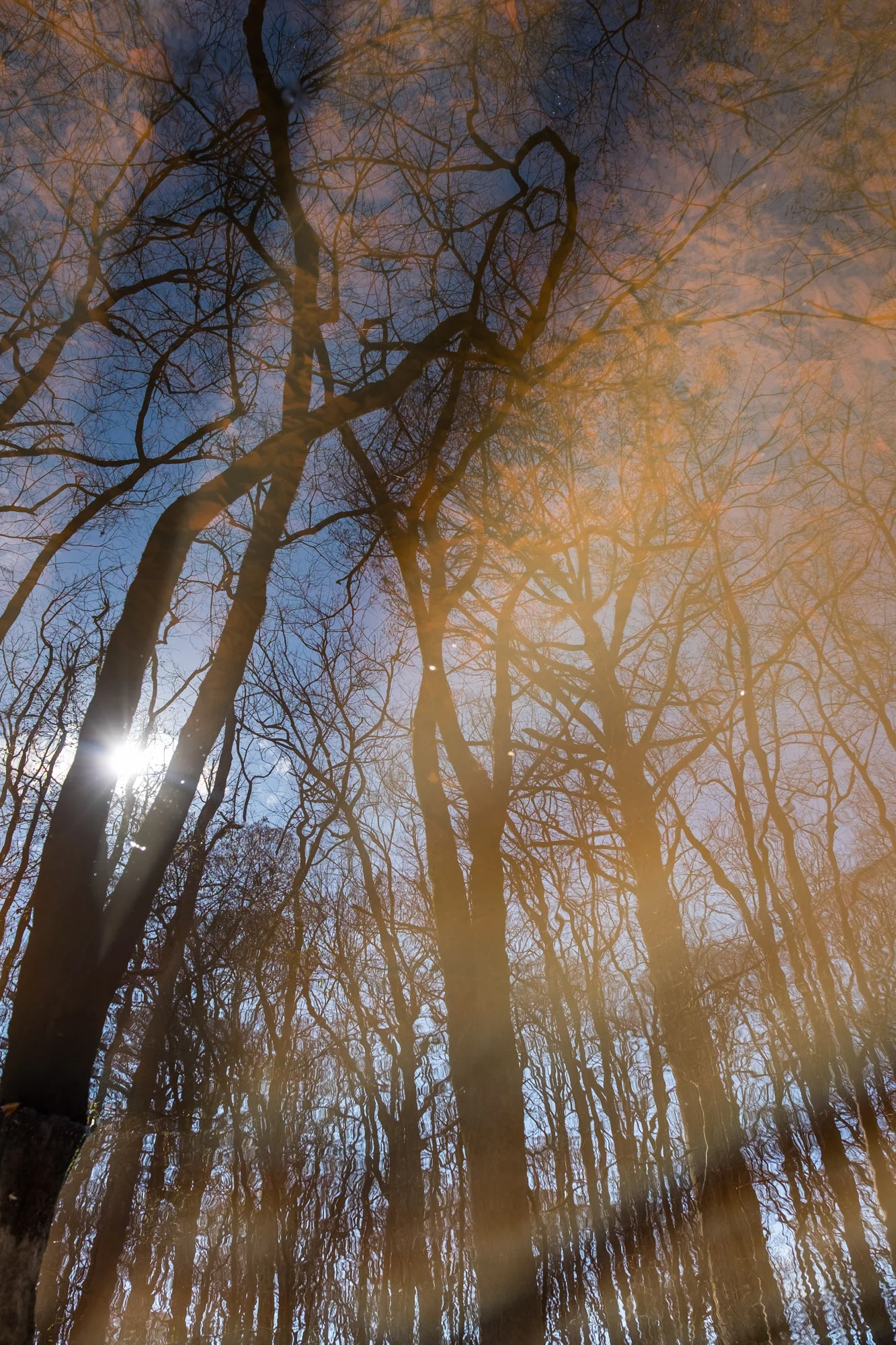
We trekked the boardwalk knee-deep in water, thankful to be there when it was cold and mosquito-free; and at the end of the boardwalk, we hiked on to a series of trails. In terms of miles that day, we didn’t get very far. It's not about the length of land that you travel, though, but of the value of what there is to explore. There is much to get distracted by... fallen Cypress trees so enormous that they must have shaken the Earth when they hit the forest floor, reflections of the trees precise in the stillness of the water, all of it ripe to be explored and photographed. As mentioned in our Great Smoky Mountains article, the benefits of traveling during off season are astounding. If we felt as though we had the Smokies almost all to ourselves, we knew that we had Congaree to ourselves. We were the only people out there that day. Seriously, we checked.

Stef hits a stretch of dry path.
When we set off on this project, we knew we would be exploring incredible parks during the winter and would miss opportunities to capture and share perfect sunsets, vibrant foliage, flora and fauna, and other beautiful moments. For a photography-based project, that is of course not the ideal scenario. But we had the BEST time. We didn’t see much wildlife when we were there, nor did we see wildflowers, or drops of sunshine or rainbows, but the plain-clothed ranger was right—when you stop and listen, the whole forest opens up and you can hear every breath of wind, every branch twist and fall, every tiny bird whistle and chirp.
One can’t stand still forever, though. On to the next!

Quotable Images


Fact Box
24,180 acres | Home to the largest old growth hardwood forest in the American southeast

Always thankful for the U.S. National Park Service for preserving for us these wonderful places!
Official name: Congaree National Park
Established: November 10, 2003
Location: Central South Carolina
How the park got its name: The park is named after the Congaree People, an American Indian tribe, who lived in the area of central South Carolina before it was inhabited by settlers.
Iconic site in the park: The trails among the Cypress trees. Preserved at Congaree National Park is the largest tract of old growth bottomland hardwood forest remaining in the United States. The trees growing in the area are among the tallest in the Eastern U.S.
Accessible adventure: The undisputed champion of this park is the elevated Boardwalk Loop, stretching 2.4-miles (3.9 km) from the Park visitor center through the forest and its surrounding waterways. Slightly less accessible when covered with water.
Big adventure: Canoeing or kayaking Cedar Creek provides 15 miles of Congaree Wilderness to visitors where they can explore the primeval old-growth forest from within, while viewing various wildlife species such as river otter, birdlife, deer, turtles, armadillos, snakes, and alligators.

Mosquito meter at Congaree National Park Visitor Center.
Did you know?
The mosquito meter at the visitor center ranges from “1 - All Clear” to “6 - War Zone!” You can find the war zone during summer months.
Until 2003, when Congaree became the first and only national park in South Carolina, it was known as the Congaree Swamp National Monument.
American Indians used the wood from the Cypress trees to make canoes and structures, so much so, that there is very little of this tree left in North America.
Within the park are cattle mounds. These mounds were built to allow livestock to climb to higher ground during floods. In 1996 these mounds were added to the National Register of Historic Places.
During the last 20 years, visitors from over 100 different nations have signed the guest register at the park.
At Congaree, you will find one of the most diverse forests in North America, with 22 plant communities living in the park.
