
Mount Rainier National Park, Washington, USA | 39/59


Easy Ways to Explore Mount Rainier National Park in Washington State
On the road in Mount Rainier National Park.
If you’ve ever been to the city of Seattle and looked off into the distance on a nice day, you have undoubtedly seen a glimpse of Mount Rainier on the southern horizon rising like a champ from beyond the city. What you cannot see when looking at it from that vantage point is the ancient Douglas fir, cedar, and western Hemlock forests at the base of the mountain where a diverse biological ecosystem thrives; or the major rivers (there are six) created by the enormous glaciated stratovolcano; or the sub-alpine meadows bursting with colorful blooms of wildflowers; or the wild kingdom of animals that live there. They are there, though, as they have been for millennia.
To the city-goer, Mount Rainier wears one face as a prized local legend; to the adventure set, Mount Rainier National Park is an otherworld located just two hours driving from downtown Seattle. There are endless ways to explore it—backpacking, hiking, mountaineering, skiing, snowshoeing, cycling, rafting, paddling, car-camping, wildlife watching, photographing the landscapes—the sky is a limit effected only by the time of year that you choose to visit and what your personal interests are.
For this project, we wanted to take it easy and go camping with some friends in an insanely beautiful place that has been home to us both at various times in life. This article focuses in on the different areas within the park, where to camp, awesome landmarks not to miss, as well as some basic information about the namesake of Washington’s favorite national park—we’ll lead with that.
About Mt. Rainier: Mount Rainier is the most glaciated peak in the lower 48 standing 14,410 feet above sea level. Despite its name, it is not a mountain, but an active volcano. Those who've grown up in western Washington have long been cautioned that Rainier could erupt and devastate the Emerald City in its entirety at any given time... to locals, it is a guardian and a foe looming larger than life over the city. To explore it, you can go soft and head off into the extensive trail networks in the lowland forests; go big and hike the 93-mile Wonderland Trail that circumnavigates the sub-alpine and high mountain; or go really big and summit Rainier the way national park hero and conservationist John Muir did more than 100 years ago... or, you can simply admire its beauty from the forest floor.
5 areas in the park to explore: The heart and soul of the park is the high peak of Mount Rainier. Once you know where that is—smack in the middle of protected parkland—you can more easily start to navigate the areas surrounding it.
Longmire (southwest) – The Longmire area, born of James Longmire's homestead and mineral springs resort, served as central headquarters for the park during its early years at the beginning of the 20th century; today, it is a small designated national historic district that preserves the cultural history of the park. It is located in the southwest corner near the Nisqually entrance.
Paradise (southwest) – Year after year, this remains the most popular section of the park because it is easy to access and also because of the sheer volume of things to experience in the area including waterfalls, gorgeous displays of wildflowers during peak season, access to hiking trails, visitor centers, an epic scenic driving road, and the ever so popular campground at Cougar Rock. This is also the main access point for many winter activities as well, and from where to start the Wonderland Trail hike and a summit of Rainier.
Ohanapecosh (southeast) – This area on the southeast side of the park is home to the ancient, supernatural-seeming old-growth forests that the Evergreen State is known for. It is drier and sunnier on this side of the park than it is on the more popular Paradise side, so if you run into marine weather, hop in the car and head east! There is excellent camping located by the visitor center in Ohanapecosh as well, but only during summer—this side of the park including its east-facing entrance is closed during winter months.
Sunrise (northeast) – Located at 6,400 feet of elevation, Sunrise is the highest point in the park that can be driven to. Positioned on the north side of the mountain (60 miles northeast of the Nisqually entrance) visitors find wide open vistas, sub-alpine passes, valleys and meadows, and panoramic views of the dramatic Cascade Mountain Range—and on a clear day and with a little luck, views of Mt. Rainier and Mt. Adams.
Carbon/Mowich (northwest) – This area located northwest of Mount Rainier is the least visited section in the national park due to limited access via road aside of the temperate summer months. There are upsides to this of course, such as peaceful surroundings and unspoiled nature. Carbon is known for its temperate rainforests and Earthly coal deposits; Mowich for a glacial basin surrounded by meadows that burst with wildflowers each year. It is vital to check the park road status before making plans to visit this area as closures are common.


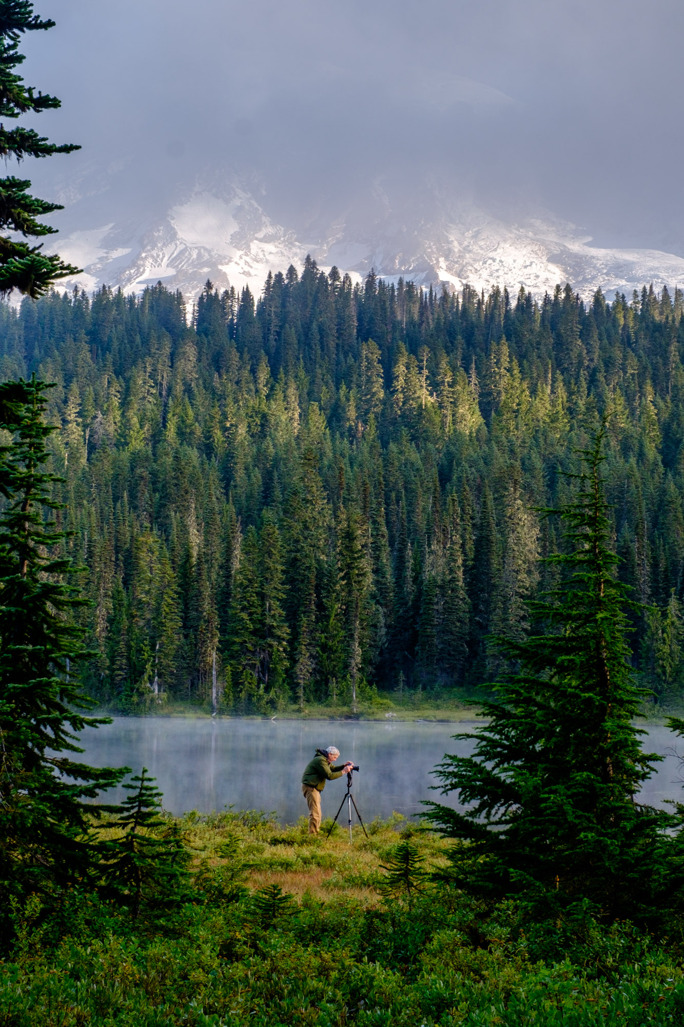
Pictured from left: Flowing rivers in Paradise; old-growth forests in Ohanapecosh; and a sub-alpine lake in Sunrise.
Wally the Airstream found camping bliss at the Cougar Rock Campground in the Paradise section of Rainier.
Cougar Rock Campground (Paradise)
There is excellent camping at three established campgrounds in the park. We opted to stay at the most popular, the Cougar Rock campground (3,100 feet), because of its convenient location in Paradise and awesome laid-back vibe. Campsites are suitable for tent camping as well as boondocking (for those with travel trailers/RVs) and most have plenty of space to set up multiple tents. The sites are pretty basic—flat forest floor, parking, a picnic table, and fire ring. What sets this area apart is that is has easy hiking trails starting right in the campground that lead to the Nisqually River; an amphitheater where park rangers give nightly talks and hold special events for junior rangers and younger kiddos/junior rangers-in-training; and best of all are the scenic surroundings that showcase evergreen trees for days. All three campgrounds are open during summer only.
The Paradise Jackson Visitor Center (Formerly the Henry M. Jackson Visitor Center, Paradise)
Entering through the historic national park gate at the Nisqually entrance on the southwest side of the park, you are greeted by a wall of evergreen trees that enfold you the entire way up the paved Nisqually-Paradise Road to where the largest visitor center in the park is located. The historic Jackson Paradise Visitor Center was part of the Mission 66 program, for which Mount Rainier National Park served as a pilot location to test the viability of expanding and improving visitor services inside of the national parks. At the time, the restaurant, museum, ski rental shop, and warming hut that were developed there were cutting edge, as was the deviation from rustic park architecture favoring a more modern design. Today, the newly constructed visitor center (the original was demolished in 2008) is without a doubt one of the most beautiful visitor centers in any of the U.S. national parks, with views overlooking the Cascades as well as a park store, cafe, auditorium, and plenty of exhibits designed to teach visitors about the the past, present, and future of the park.
Nisqually-Paradise Road courses through the evergreen trees and on up to the Paradise Jackson Visitor Center.
The entrance to Skyline Trail from the steps leading away from the Paradise Jackson Visitor Center is commemorated by touching words by John Muir.
Reflection Lakes holds up a mirror for Mount Rainier, Washington state's beloved stratovolcano.
Reflection Lakes (Paradise)
This series of sub-alpine lakes is where some of the most celebrated photographs of Mount Rainier are created. Walking portions of the 5-mile loop trail or even just standing aside the lake, you will get a clear view of the enormous volcanic peak on a clear day, and a shift in perspective with every step as the intense Rainier weather system breathes fog, mist, and clouds in and out of the scene. This is an incredibly peaceful place to explore, hike, and just be. If you are looking for more of a challenge, you can push on along the trail to a rocky bluff where you can see clear view of the Tatoosh Range, and later, the Paradise River.
Christine Falls (Paradise) – Christine Falls and the Christine Falls Bridge that frames it in view is as iconic as it is accessible, located down a short set of stairs from Nisqually-Paradise Road. There are a few different views, the one from eye level being the most classic to photograph. This is your first waterfall stop after entering the Nisqually entrance and is well worth taking a moment to breath in the the clean, misted mountain air.
Skyline Trail (Paradise) – This 5.5 mile trail gains 1,700 feet of elevation and is one of the most popular trails in the park as it allows up-close-and-personal views of Mount Rainier and Oregon’s Mount Hood, the Nisqually Glacier, and vast meadows and panoramic vistas. This area is also teeming with wildlife—best seen if you walk softly and allow the wilderness to show itself to you.
Narada Falls (Paradise) – Easy access down a short paved platform to this roaring two-tiered, 176-foot waterfall makes it one of the most popular places in all of Mount Rainier National Park. The scene is spectacular, and there is area to explore more... traveling farther down a short, wet, and incidentally slippery path, you'll reach the bottom of the falls to meet a glorious view when looking skyward.
Sourdough Ridge Trail to Frozen Lake (Sunrise) – Just north of the Sunrise Visitor Center parking area is this 3-mile loop trail that climbs 500 feet in elevation along vast expanses that overlook alpine lakes and valleys shrouded in various hues of technicolor green. On clear days, views of Mount Rainier, Mount Baker, and Mount Adams can all be seen in the distance. One of the coolest things about this trail is that is a member of a larger network of trails, so you can extend and/or alter your hike as you wish and explore higher and farther if you are prepared for it with adequate food, water, and clothing.
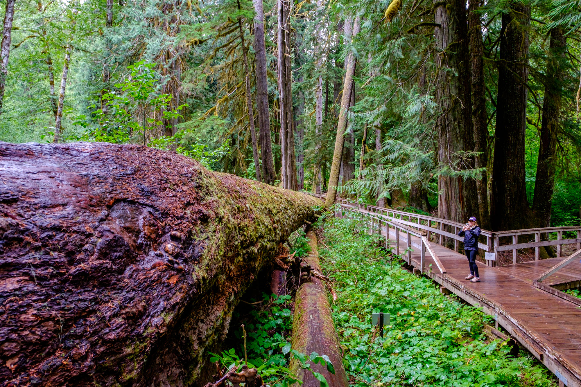
Grove of the Patriarchs (Ohanapecosh) – In the drier and sunnier eastern side of the park is a beautiful 1.5-mile loop trail meandering 1000-year-old trees in an old growth forest comprised of western red cedar and Douglas fir trees. As you wander the perfectly groomed and very popular trail, you will find yourself at a short, low suspension bridge crossing the Ohanapecosh River to a river bank—a really cool place to capture photos—before continuing on into the ancient forest. This trail is a favorite for families, tree huggers, and those eager to experience Washington state's most natural old-world charm.


Quotable Images


Fact Box
235,625 acres | 97% designated wilderness | The entire park is a dedicated National Historic Landmark
Official name: Mount Rainier National Park
Location: Western Washington, 53 miles south of Seattle
Date established: March 2, 1899
How the park got its name: In 1792, English explorer George Vancouver was on a sailing expedition aiming to uncover the secrets of the Puget Sound when he caught sight of a beautiful imposing peak in the distance. He named the mountain “Rainier” honoring his friend, Rear Admiral Peter Rainier, who sailed alongside him. Baker named many geologic features in Washington state after his associates, including Mount Baker, Mount St. Helens, the Puget Sound, and Discovery Bay.
Mount Rainier mirrored in Reflection Lakes in the Paradise area of the park.
Iconic site in the park: The view of Mount Rainier as seen from Reflection Lakes offers what is perhaps the most iconic view of the stratovolcano—there you see it twice, once in the water and once in the sky. The freshwater lakes hold a mirror for the 14,110-foot peak that draws nearly 2-million people to the park each year, and for the spring and summer wildflower blooms and fall foliage that decorate the landscape that surrounds it with rich color. This is not a fishing lake, a swimming lake, or a body of water to play fetch with Fido in, but a still body of water (when the wind and weather cooperates) where some of the most beautiful photos of Mount Rainier are conceived. After wrangling an often hard-to-come-by parking spot at the multi-use Stevens Canyon Road parking area, take an easy stroll to the lake, then head out on a 2.75-mile loop trail around the perimeter, or farther along a 5-mile loop hike that winds into the lowland forests. The best time to hit this spot at sunrise when solitude and stillness have not yet been effected by the masses (save early morning photographers trying to get the iconic shot.)
Accessible adventure: In Ohanapecosh located in the southeast corner of the park you can wander into an alternate storybook universe that exists within the old-growth forests of Washington state in the Grove of the Patriarchs trail. The ancient forest is lined with statuesque cedar trees, Douglas fir, and western Hemlock, accented by lush green vegetation blanketing the landscape at every turn. Along this relatively easy 1.5-mile hike (with zero elevation gain) there is much for adventurers of all ages to discover, and a surprisingly hushed sense of peace laid down by trees that reach to the heavens dwarfing all humans whom wander beneath their massive trunks. Along this busy trail you will cross a short and low-to-the-river suspension bridge (fear not for exposure, this one is easy) to a collection of ancient, 1000-year-old-trees before returning to the parking area on the loop trail.
Big adventure: There is no greater adventure in Mount Rainier National Park than hiking the infamous Wonderland Trail, a 93-mile circumnavigation of Washington's highest peak. The hike is strenuous, crossing lowland forests into the high alpine areas of Rainier, while enduring cumulative elevation gain of 22,000 feet. Weather, conditions, and personal ability will effect the duration of any hiker’s multi-day journey on Wonderland, the typical output averaging 8 miles per day (no snow) and 6 miles per day (with snow.) This is no day hike—this is the big leagues... making way to designated backcountry campsites, preparing adequate food supply, and planning efficient pack weight are all considerations; as is knowing your own ability level and understanding the weather systems. Explorers assume all responsibility for their personal safety in America's national parks while tackling big adventures like this one. And the reward is grand! Wonderland is the ultimate hiking prize in the Pacific Northwest, and is one of the most popular trails in the nation.
Crossing the Ohanapecosh River suspension bridge along the Grove of the Patriarchs trail... in search of thousands-of-years-old trees at the trails end.
The Wonderland Trail circumnavigates the high alpine areas beneath Mount Rainier's summit. Trailheads to other trail networks intersect throughout the park as can be seen in the sub-alpine area of Sunrise.
“There is a trail that encircles the mountain. It is a trail that leads through primeval forests, close to the mighty glaciers, past waterfalls and dashing torrents, up over ridges, and down into canyons; it leads through a veritable wonderland of beauty and grandeur.”
Did you know…
At 14,410 feet, Mount Rainier is the highest peak in the Cascade Range and in all of Washington state. It is the 5th highest peak in contiguous U.S., and the 21st highest in the world.
For Super Bowl XLVIII, the Washington State Senate passed a resolution temporarily renaming Rainier to Mount Seattle Seahawks, effective until midnight after the game – which they won by the way. Go Seahawks!! #12s
Mount Rainier is an active volcano, a “stratovolcano” actually, and is a relatively young one (about 500,000 years old; the Cascade Mountain range, by contrast, is more than 12-million years old.) It holds rank among 15 other “Decade Volcanoes” targeted for study by the International Association of Volcanology and Chemistry of the Earth's Interior (IAVCEI), an organization dedicated to establishing a better understanding of the destructive nature and close proximity to populated areas of the designated peaks. Mauna Loa on the island of Hawai’i is also included among the 16.
Mount Rainier’s last eruption occurred about 1,000 years ago.
A more imminent threat than an eruption of Mount Rainier is the possibility of a lahar, deep destructive flooding of water and debris that could demolish surrounding areas.
Washington state’s other active volcano, Mt. St. Helens, is located about 3 hours driving from Mount Rainier. Its last major eruption was in 1980.
John Muir and his climbing team at the summit of Mount Rainier in 1888. Pictured left to right: D.W. Bass, P.B. Van Trump, John Muir, N.O. Booth, E.S. Ingraham. (Photograph by Arthur Churchill Warner)
“The grandest excursion of all to be made hereabouts is to Mount Rainier, to climb to the top of its icy crown. ”
In 1870, the first well documented summit of Rainier was recorded to have been completed by General Hazard Stevens and Philemon Van Trump (who later summited aside John Muir, see photograph, right.)
Located at 10,188 feet on Mount Rainier, between the Nisqually and Paradise Glaciers, is "Camp Muir," the most widely used base camp for climbers attempting to summit the volcanic peak. Muir summited Rainier in 1888. He later penned an essay about it titled "An Ascent of Mount Rainier." It was Muir who recommended that the area be preserved and protected as national parkland.
In 1962, Mount Rainier was used as a proving ground to prepare for what would become the first successful American expedition summiting Mount Everest in Nepal.
Glaciated Mount Rainier standing at 14,410 feet is a dreamscape for mountaineers.
Summiting Mount Rainier requires vertical elevation gain surpassing 9,000 feet over a distance of more than 8 miles. Conditioning and preparation is key to completing the climb. Weather conditions can change drastically without warning, wind is monstrous at the high elevation, and numerous other factors make it a harrowing endeavor even for the most fit. It can be dangerous for those who are unprepared, and epic for those who are up to the challenge. Of 10,025 people who attempted to summit Mount Rainier in 2015, about half of them made it to the top.
Nine of 11 members of Project Pelion, a group of climbers with disabilities, reach the summit of Rainier in 1981.
Mount Rainier is like Denali (formerly Mt. McKinley) in Alaska in the sense that it is so enormous and dynamic at its high altitude position that it creates its own weather systems; also similarly to Denali, some visitors to the park never get a chance to see the famed stratovolcano, the way some never get to see "the High One" when venturing to interior Alaska.
According to the National Park Service, the Paradise area is the snowiest place on Earth among those where snowfall is measured regularly. On any given winter day in Paradise you could find anywhere between 10- and 20-feet of snow on the ground (making it a ripe place for winter sport!)
The park is open year round but many areas are closed during winter when snow, ice, and avalanche conditions make many areas impassable.
According to National Geographic Travel, the 26 major glaciers found on Rainier make up the largest collection of permanent glacier ice on any U.S. peak outside of Alaska. Glacier movement is the top cause of erosion on the volcano.
A historic entrance gate located on the southeast edge of the park is made of logs from the park's forests to lend a sense of place.
Rainier NP has 42 locations placed on the National Register of Historic Places list. The entire park has been designated a National Historic Landmark District.
The "rustic style" designs and architecture at Rainier are considered to be the gold standard for National Park Service buildings in parks across America. Buildings and structures are often made of natural materials such as stone and logs to mimic the national environment of the area.
The climate is heavily influenced by marine weather flowing in from the Pacific Ocean located to the west of the park, elevation, and latitude. In other words, weather is a mixed bag. Plan for rain anytime, whiteout conditions in the winter, and beautiful sunny weather in the summer... sometimes. The east side of the mountain is drier and sunnier than the western side.
The National Park Service contracted Washington State University in 1963 to research historic use of the park by Native Americans. While it was determined that humans used the area between 8000 and 4500 BP, there was no evidence to prove permanent settlement, but instead that it was a place for hunting, fishing, gathering, and for spiritual quests by five tribes in the neighboring watershed boundaries: the Nisqually, Puyallup, Muckleshoot, Yakama, and Taidnapam.
Native Americans living in the surrounding areas of Mount Rainier called it Tacoma, or Takhoma, which for a time during the 19th century was used interchangeably to refer to the mountain. "Tacoma" translates as "she who gives us the waters" or "the mountain that was god" in native languages.
Wildflowers still dusting the landscape late in the 2016 summer season.
Rainier as well as Olympic National Park and North Cascades National Park (both in Washington) are known for impressive displays of colorful wildflowers during peak bloom each spring and summer season.
In 1899, the year that the park was established, there were 200 visitors to Mount Rainier National Park. In 2015 and 2016, more than 2 million visitors were welcomed, making it the 5th most visited national park in recent years.
A marmot hangs out on Skyline Trail.
One fantastic reason to head to Rainier is to drink delicious wine and beer grown and crafted in adjacent areas to the park. Yakima Valley grows 75% of the country's brewing hops used to make beer; and lets not even start on the incredible wine made in Yakima, Walla Walla, Columbia Valley, and at the apex of them all atop Red Mountain.
Common wildlife in the park include black bear, cougar, coyote, raccoon, fox, porcupine, deer, marmot, elk, and mountain goat. Birdlife also abounds with the bald eagle, ptarmigan, peregrine falcon, golden eagle, steller’s jay, and spotted owl being just some of the most impressive.
A map of the Wonderland Trail, from a 1921 Rainier National Park Company publicity brochure. The map shows the location of campsites for the company's saddle and pack horse outings around the mountain. Note that the indicated route crosses directly over the Winthrop Glacier.
NPS Archives
Happy birthday to the Wonderland Trail! The infamous thoroughfare circumnavigating the high peak is one of the most popular backpacking trails in the park (and the country) crossing 93 miles. The trail turned 100 years old in 2015. The original route was much longer, 140 miles. Approximately 250 people complete the trail each year; with thousands completing small sections of it at a time.
Getting married as well as scattering ashes of the deceased are both legal in the park with proper advance permitting.
Mount Rainier was the first national park to be created after the establishment of the National Forest System, an effort which would enable protection of a resource rather than an area – in this case, the resource was trees subject to heavy logging during the turn of the century.
Mount Rainier is pictured on Washington state's license plate and state quarter.
Mount Rainier is America’s fifth oldest national park, behind Yellowstone, Sequoia, General Grant (which is now a part of Kings Canyon), and Yosemite.
“If all the beasts were gone, man would die from a great loneliness of spirit. For whatever happens to the beasts soon happens to man. All things are connected.”